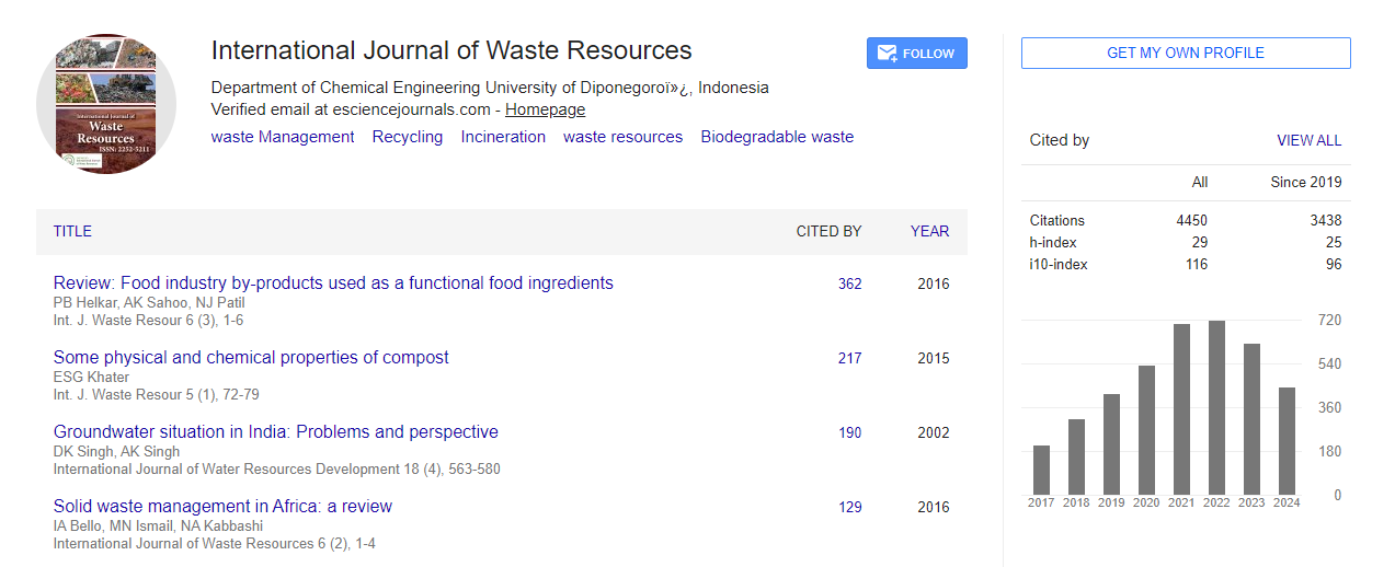

Indexed In
- Open J Gate
- The Global Impact Factor (GIF)
- Open Archive Initiative
- VieSearch
- International Society of Universal Research in Sciences
- China National Knowledge Infrastructure (CNKI)
- CiteFactor
- Scimago
- Ulrich's Periodicals Directory
- Electronic Journals Library
- RefSeek
- Directory of Research Journal Indexing (DRJI)
- Hamdard University
- EBSCO A-Z
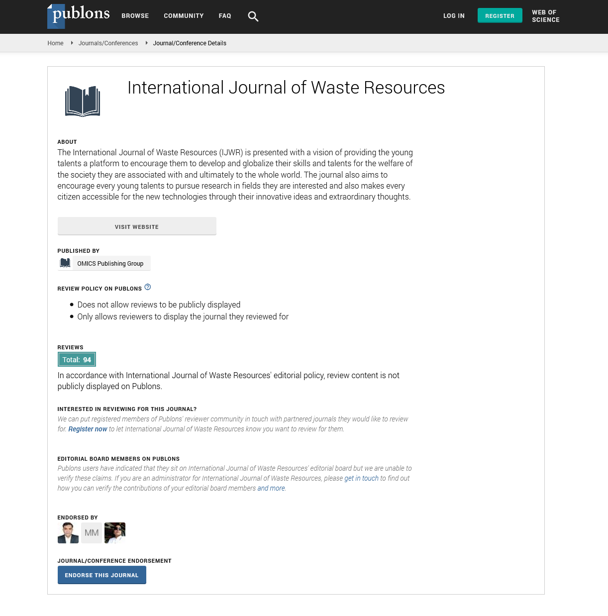
- Publons
- Google Scholar
Useful Links
Share This Page
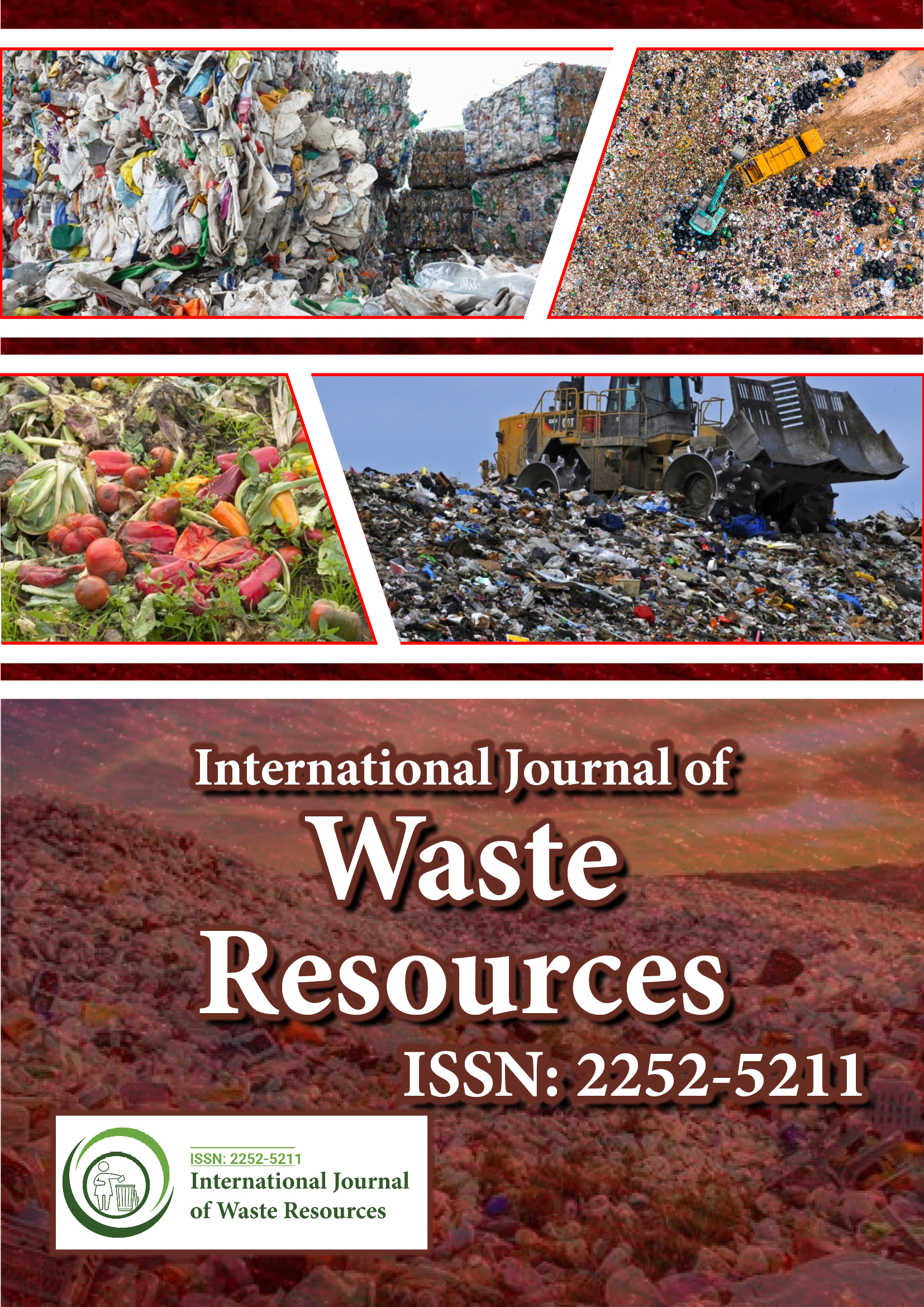
Journal Flyer
Open Access Journals
- Agri and Aquaculture
- Biochemistry
- Bioinformatics & Systems Biology
- Business & Management
- Chemistry
- Clinical Sciences
- Engineering
- Food & Nutrition
- General Science
- Genetics & Molecular Biology
- Immunology & Microbiology
- Medical Sciences
- Neuroscience & Psychology
- Nursing & Health Care
- Pharmaceutical Sciences
Contamination of the groundwater using model and GIS methods in central-Tunisia: Arid zone
World Congress on Sustainable Waste Management
June 21, 2023 | Webinar
Rim Missaoui
University of Gabes, Tunisia
Scientific Tracks Abstracts: Int J Waste Resour
Abstract:
In recent years, Regueb basin has been facing groundwater quality degradation due to the excessive use of fertilizers and pesticides, which is the result of strong agricultural activities. Physicochemical elements (TDS, NO3-) and several factor types (geologic, hydro geologic, and geomorphologic) were used in this study. The weighted model (TDLFSGC) was used to determine the groundwater Vulnerability Index (VI) to the pollution which is subsequently validated by Pearson correlation with nitrate concentrations. The results show that the TDS in groundwater ranged between 1.19 g/L and 16.92 g/L and the NO3- concentrations varied from 150 to 920 mg/L. The vulnerability map generated using GIS shows three classes of VI in the study area, namely low (31.5-60), moderate (60-75), and high (75-13). The validation of the vulnerability model revealed a good correlation with NO3- and provided a high discretization of the groundwater vulnerability from anthropogenic pollution. This approach implies that more efforts should be taken to preserve the groundwater of the Regueb basin from contamination. And it could be used as a tool for water resource management in the future in similar regions.
Biography :
Rim Missaoui completed his studies in University of Gabes in the Department of Water Sciences located in Tunisia. He was one of the member in International Association of Water Resources in the Southern Mediterranean Basin in Gafsa, Tunisia. He currently working as Faculty of Sciences in the University of Gafsa. His research works are well known with the geology theory. He also gone through some practical knowledge in the Laboratory for the Application of Materials to the Environment, Water and Energy (LAM3E).